Tuesday, May 23, 2006

Torreys North Chute Snowboard Descent - May 14th, 2006

A snowboard descent from Torreys Peak (14,267 ft) is one of the longest continuous descents you can get in Colorado from a 14er. On the North face you can get about 3,000 vertical feet. I was planning on doing the North West Couloir of Torreys (or also called Tuning Fork) this Sunday with the snowboard. I started early since temperatures were not supposed to drop very much overnight. I could drive all the way to the official Grizzly Gulch summer trailhead. The jeep road afterwards still had quite some big snow banks. I hit the trail finally at 5:30 am, a little later than first planned. But the temperature at the trailhead was 30 degrees, which was all right for a decent freeze on the mountain.


Picture 1: Torreys from the trailhead at 5:30 am (click on pictures to enlarge)

I just hiked it in my snowboard boots, no snowshoes required. However one time I tried to take a short cut through the trees and started post holing. So I went quickly back on the trail, which was pretty firm. It took me about 1 ½ hours to get to the bottom of the couloir. Then the hard work started. The couloir has a steady pitch of about 40 degrees.


Picture 2: The northwest face couloir

Luckily there were some nice kick steps from somebody who did it the day before. I did not need any crampons since these were pretty nice steps. But the ice axe is definitely recommended. I was the first one up the couloir. Later on I saw two other climbers make their way up.
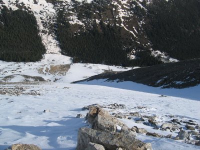

Picture 3: Looking down the north west face couloir (about half way up)
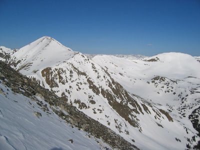

Picture 4: Grizzly Peak, seen from the couloir

The couloir took me about 3 hours. Somewhat out of breath I got to the top where 7 other people were hanging out and suddenly heard my name. What a surprise: My co-worker Lacy was up there with three other friends. What are the chances of that !?! They skinned/hiked up from Steven’s Gulch.


Picture 5: Me on the top


Picture 6: Panorama on Torreys

(I can not get it to enlarge the right way, freaking blog thing!)


Picture 7: Lacy and his friends Brittany, Andrew and Dave

After enjoying the view, and taking some pictures we got ready for the descent. Lacy’s group was considering the south facing Dead Dog Couloir. However they opted for the North Chutes (Emperor). They had a second car already at the Grizzly’s Gulch trailhead. I decided to join them.

Picture 8: Brittany navigating through some rocks near the summit


Picture 9: The snow was pretty firm on top but still fun


Picture 10: Looking down the steep stuff


Picture 11: Andrew ripping the steep part


Picture 12: Dave on the upper steep couloir

The rollover on top is probably close to 50degrees. Later on it’s about 45 degrees for a while and the bottom part usually around 40degrees. I heard that some years parts of this needs to be down-climbed. However today this was all do-able on skis/snowboard. The upper part was hard-packed, bomb-proof snow, later on it softened up nicely and at the bottom it was quite slushy.
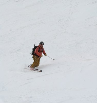

Picture 13: Lacy the tele-guy


Picture 14: Dave in action


Picture 15: The snowboarder


Picture 16: Our line down the North Chutes (Emperor)

Overall I would say this is a very good line. You will see some more variable, interesting terrain than in the northwest face couloir. I can definitely recommend this route in safe spring conditions. The roundtrip time was about 7 hours. (4 1/2h ascent, 1/2 hour lounging on top, 1 hour descent, 1 hour hike out)

For another trip report and some more pictures from Brittany, see
http://www.tetongravity.com/forums/showthread.php?t=53798
Wednesday, May 10, 2006

Moab Mountain Biking - May 6 to 8, 2006

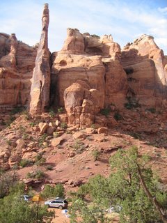
We went for a weekend of mountain biking and camping to Moab in Utah. After about a 6 hour drive on Friday evening we got there around midnight. The bumpy road up to the Gemini bridges area woke everybody up again, and with the second try we found a site where we pitched the tents. It turned out to be quite a great campsite! Nicely secluded and just below a great spire.


Picture 1: What a campsite !
(click to enlarge)


Picture 2: Jaya and Rob hanging out at the campsite


On Saturday we did the Golden Bar Rim trail, linked it with the Golden Spike trail and went down through the portal. There Steve and Doug decided they did not have enough yet. Zach joined them for the first part but later on decided to return. Steve and Doug pushed on for a mammoth 11hour day of riding. They got back to the campsite after it was dark.


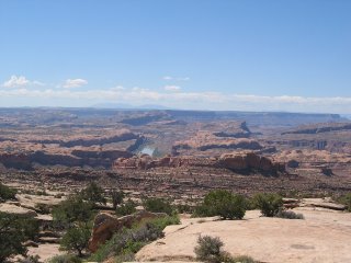
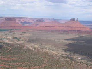
Picture 3: View from Golden Bar rim trail


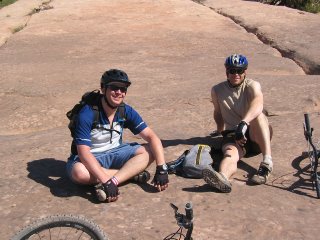
Picture 4: Rob and Doug taking a break


Picture 5: Zach riding hard


Picture 6: Steve


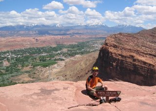
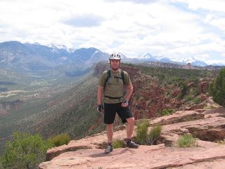
Picture 7: Taking a break on top


Picture 8: At the portal


Picture 9: Snow, desert and greens


On Sunday we took it a little easier and did the Porcupine Rim Trail. This is a great down hill ride. Jaya was very nice and provided us with a shuttle ride. Thanks again!


Picture 10: Steve on top of Porcupine Rim Trail


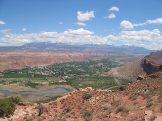
Picture 11: View from top of Porcupine Rim Trail


On our last day on Monday we did the Amasa Back Trail.


Picture 12: On top of Amasa Back Trail


All together this was a nice long weekend in the Moab desert with some great riding, relaxed camping, enjoying the sun and having a good time with friends.


Wednesday, May 03, 2006

Quandary Snowboard Descent - April 30, 2006

Inspired by Chris Davenport’s project (www.skithe14ers.com) I decided to do one of those fourteeners as well. Now the conditions seemed to be perfect. We had a few weeks of warm spring weather behind us and the snow pack is very stable in the mornings. So I looked for one of the easier fourteeners. Quandary Peak is recommended for a first-time 14er ski/snowboard descent. Quandary Peak is 14’265 feet high (=4350m). This peak is just a few miles south of Breckenridge. The East Ridge approach can be easily scoped out from highway US-9. I did this the week before after snowboarding the closing day in the Breckenridge ski resort. Originally I was planning to descent through the Cristo Couloir on the south face. However we opted to do the easier East Ridge.


Picture 1: The object of desire
(picture taken the week before)
Click to enlarge


Picture 2: Descent route on the East Ridge (picture taken the week before)


My co-workers Doug and Stefan, Stefan’s roommate Chad and my wife Jaya joined me for this venture. We started at 8:30 from the trail head. That is a little later than the norm, but since the temperatures were forecasted to stay quite low it would not be a problem. We only wanted to make sure to be back at the car before some late afternoon snow was supposed to move in. But that came quite a bit different than forecasted, as you will see…


Picture 3: Getting ready at the trail head


Picture 4: Jaya and Doug hiking up to the tree line


Picture 5: The whole crew: Stefan, Doug, Jaya and Chad


During the first mile hike Jaya felt a blister building on here heel. We found out that her boot was actually soaked with Gatorade since one of the Camelbaks was leaking in the car. We noticed the empty bladder back at the trail head but we could not find any gear that was wet. Nice surprise to find this out now on the trail !! We taped her heel up and continued.

After we gained the tree line the wind started picking up and some light snow started falling.


Picture 6: That wind makes the snowboard feel heavy


Picture 7: Chad searching for some wind protection

The conditions deteriorated quickly. The wind was howling and some dark snow clouds moved in. Jaya was not too excited about fighting through this weather and feeling the blister on her heel. She decided to turn around and Doug accompanied her back to the car. Stefan, Chad and I pushed on.


Picture 8: Breaktime: For a German nothing tastes better than a brat on the mountain

After the quick break the weather really started to move in. We had to fight near white-out conditions. The snowboards were acting like sails in the wind and we had a tough time to stay on our feet. Stefan and Chad tried to talk me into turning around, but we were almost 2/3 up the mountain. I really would have regretted to abort it. And since Quandary is a straight forward ascent there was no risk to push on. The ridge is very wide and easy to navigate even in miserable conditions. Luckily the weather gods heard me and during the discussion the sky suddenly cleared somewhat.


Picture 9: Preparing for the snow


Picture 10: Near white-out


Picture 11: Stefan enjoying the snow

Even though it stopped snowing the wind was still blowing very hard. Chad and Stefan decided to leave their snowboard behind for the last big climb and pick it up later on again. I wanted to snowboard it from the exact summit and fought the hard winds. However I made a big mistake: I drank plenty, but forgot to eat in all that weather. So the last few vertical feet were extremely tough. I thought it was just the altitude, or that I am out of shape. I only realized on the summit that I simply ran out of energy due to lack of food. We made it all the way to the summit without snowshoes. I put my crampons on for the last climb and right on the summit we post-holed through waist deep powder but otherwise the snow was quite firm.


Picture 12: The last climb was tough


Picture 13: Chad on the last few feet


Picture 14: Even I made it


Picture 15: Chad on the summit


Picture 16: Stefan and Oliver on the summit


Picture 17: 360deg panorama

After eating and drinking to get back some energy we took the summit pictures. Than I strapped into my snowboard. The upper part was quite wind-blown, firm snow but it got better in the lower section.


18: My line of the summit

After those first few turns I met up with Stefan and Chad and we made our way down. We had to navigate through a few rocks and even take our snowboard off for a few feet. The lower bowl however was a blast. We got rewarded with some great turns. It is relatively a low angle terrain but the nice snow made it worthwhile.


Picture 19: Stefan ripping a line


Picture 20: Chad and Stefan enjoying it


Picture 21: Chad smiling after the great turns


Picture 22: Oliver’s last few turns

This easy fourteener turned out to be quite a bit more challenging than originally thought. The weather made a big difference. You have to be prepared for everything and like so often you can not trust too much the weather forecast when you are in the mountains. Our roundtrip time of almost 7 hours was quite slow. But nonetheless we were proud that the weather could not stop us and we were finally rewarded with a nice descent.


Picture 23: Tired but happy back at the car