Square Top Mountain - April 28, 2007
Here is a slightly modified copy of Scott's TGR post
http://www.tetongravity.com/forums/showthread.php?t=84207
Square Top Mountain 13,794ft - North Couloir
Snow Sliders: Scott & Oliver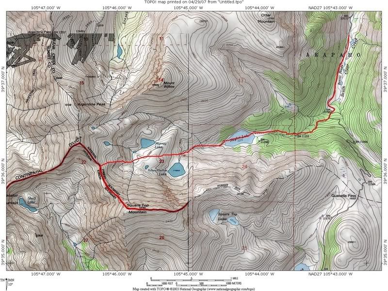
Red line shows approximate ascent route. Couloir is the stream that runs down the north face starting just above the "q" in Square.
After a phenomenal day of amazing April powder skiing on Wednesday, I was hopeful to find some remnants on Saturday, despite temps that would be in the 80's in Denver. The front range/east of the divide received the most snowfall from the storm Tues-Wed (20+ inches), and picked up a few more Thursday night. So, find something in the front range, find something that's high, and find a north facing line.
I started brainstorming ideas, and came up with about 4 options. My first choice was ruled out due to access issues. Next in line was Square Top. I've hiked nearby Mt Bierstadt a few times in the past (due east from the lower right hand corner of the topo above), so I've seen Square Top from the east several times, but had never been in the drainage to the north of the peak. Here's a shot of the peak from the east, the "standard" approach, courtesy of 13ers.com:
Here's a shot of the north face in October (courtesy of summitpost.org). Our line is on the looker's right, dropping just as the ridge begins to head down. The line more in the center of the face might be do-able with more snow...but it looked pretty thin for us, and would have required a pretty good downclimb.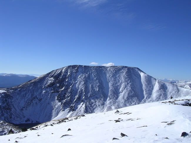
Oliver and I met up at 5:00am. Even though it was a high elevation route with a solid freeze Friday night and a north facing line, we wanted to have plenty of cushion given the sudden rise in temps forecast for Saturday, along with all the recent new snow. A wet slide cycle was impending.
The best info I could obtain indicated Guanella Pass road to be open to the Naylor Lake campground turnoff, but we came up about a mile short of that. We arrived about 6:00am, and were off shortly thereafter. The skin overall was a nice warmup - a mellow pitch on frozen snow. After a "shortcut" led us away from the actual trail to Naylor Lake for a short bit, we got back on the road, and continued up toward Naylor. The Lake was frozen solid, and we were able go right across.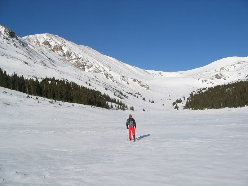
Scott skinning across Naylor Lake, north face of Square Top is on the left side of the pic.
We continued up toward the saddle between an unnamed peak just south of Argentine and Square Top. A small, but steeper side hill traverse provided some challenging skinning to get above Silver Dollar Lake. Here's a shot on the final push to the saddle ridge. Bierstadt is in the middle of the picture. The sawtooth ridge connects to Mt Evans (lookers left of Bierstadt), both 14'ers.
It was one of those special Colorado days. No wind. Not on the ridge. Not on the summit. With warm temps and clear, bluebird skies it was the perfect day. We monitored snow conditions all the way and with the snow staying firm, we were in no hurry to get to the top, as we enjoyed many (more than usual) breaks along the way to soak it in.
Soon, the ridge steepened and the snow cover on the ridge became sparse, so it was time to boot. Here's a shot with Grays and Torreys (behind) in the background (2 more 14'ers)...and I think Edwards connected to Gray's ridge, to the right. Some fun looking lines off the unnamed peak right behind me (which is also hiding Argentine).
We dropped our skis at the top of the couloir (snow was lacking for the summit descent), and hiked up the rest of the way to the summit.
Token summit pics (you can understand why it's named Square Top):
Oliver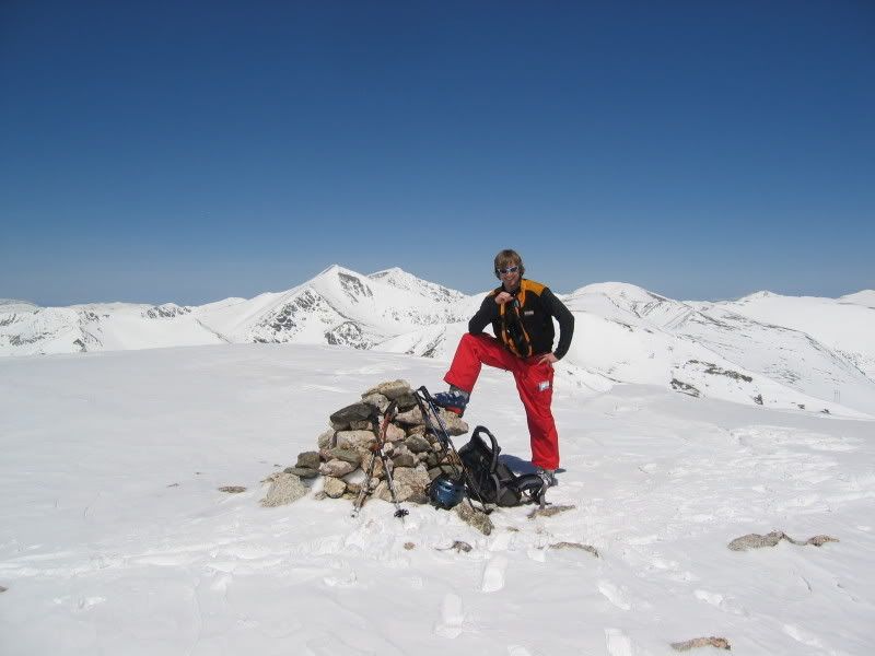
Scott being a dork
Views to the west:
View to the north west:
Looking back toward Bierstadt & Evans: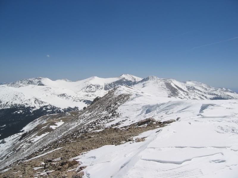
Alright, time to ski. Looking down the line: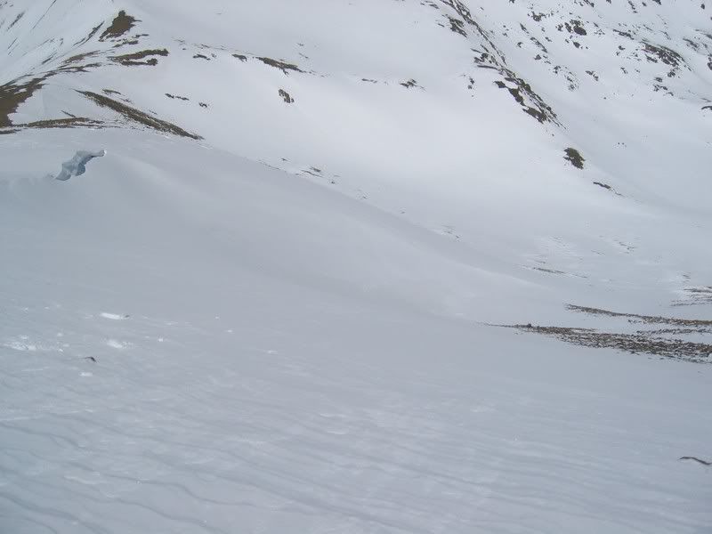
Now's probably a good time to explain why so far there's only been one pic of Oliver...and why there will be only one more. It's been a rough week for me and cameras. On Wednesday, my "good" camera stopped working...lens jammed between fully zoomed and closed. Took it by Wolf Camera today...they want $170 to have it repaired. I'm going to try and deal with Canon directly and hope for better news. So, for this trip, I was using my old 1.3MP, no zoom camera. IridePow was going to drop in first, and I was going to take some shots. I had also been taking shots along the whole approach. I get the camera out and decide I should be facing the other direction...so, I put the camera in the chest pocket in my avalung vest, and do a little hop turn to spin around. Out pops the camera. It starts sliding slowly at first, and I think it's actually going to stop on this chunk of snow...but instead, it pushes the chunk of snow, and quickly starts to pick up speed as the angle steepens. I watch it go sliding down the snow right toward a bunch of rocks, where it launches into the air and tumbles several more times before stopping somewhere in there. So, yeah...no pics from me.
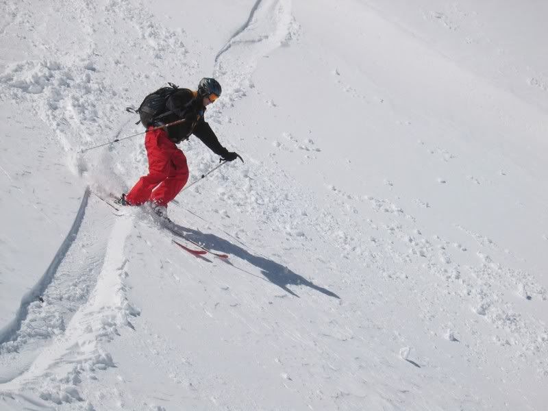
So, would there be pow? First turns weren't exactly powdery...but still very enjoyable: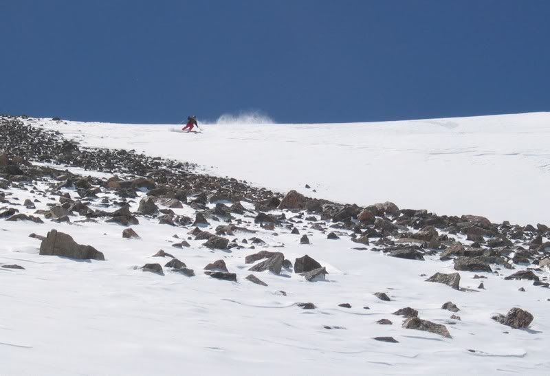
Ok, so at no point did we experience the kind of snow my wishful thinking had hoped for (some leftover deepness from earlier in the week)...but depending on where in the couloir you were at, there was some very soft snow to be found.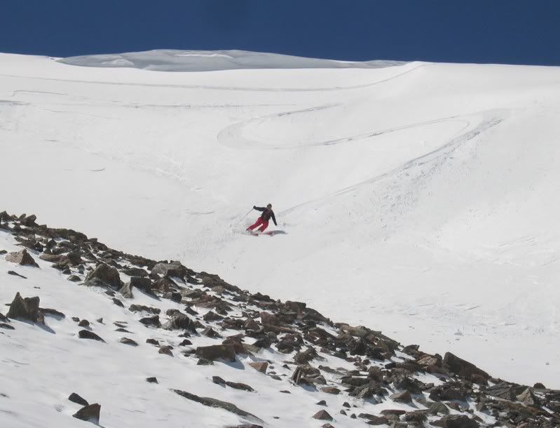
Looking back at our handiwork: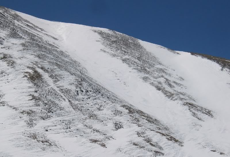
We continued down, pretty much following our ascent route the rest of the way back to the car. Oliver took a risk and let me use his camera for some turns down lower: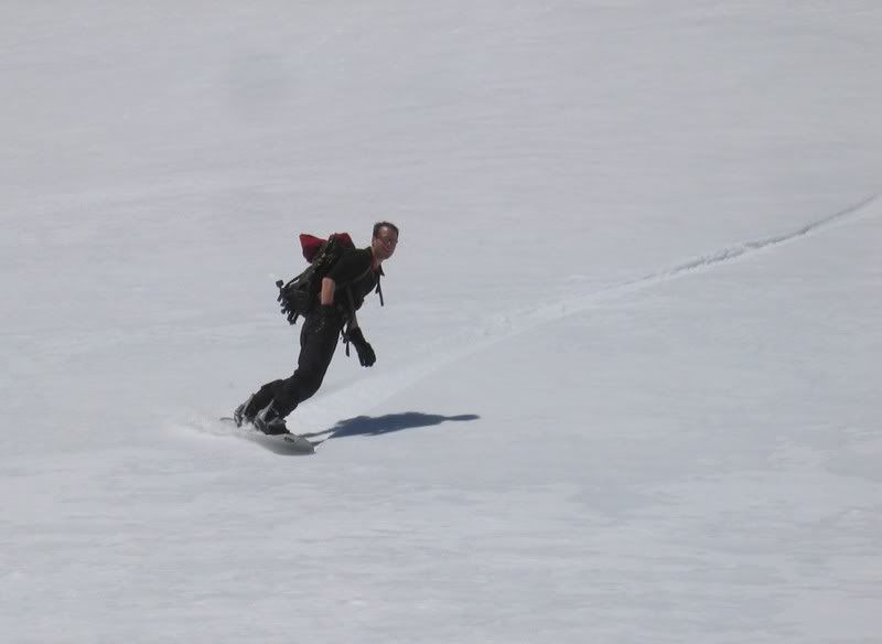
Other line more east from our descent: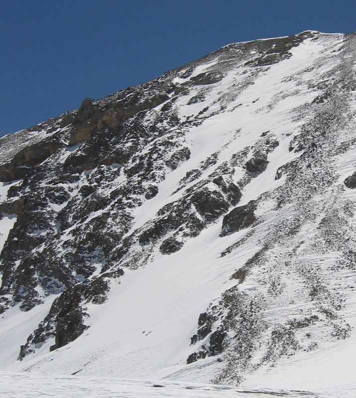

No comments:
Post a Comment