Savage Peak - May 13, 2007
Posted a little late I know.... but was just too busy snowboarding.
Savage Peak 13,139' (attempt)
Savage Couloir via Missouri Creek
5 Miles, 3,000' ish
IridePow, HikeforTurns
TR was created by Forrest (HikeforTurns) see
www.tetongravity.com/forums/showthread.php?t=85394
www.splitboard.com/talk/viewtopic.php?t=3683
All photos by Forrest
Savage Peak. Sounds appealing eh? The Savage Couloir has been on my list for a while now, and a recent reminder brought it up to the top. Unaware that the road was maintained and therefore driveable, I decided to give it a try. Yes the internet is a good place for sharing info in the form of trip reports, some may say leading to the encouragement of others to try. And this may be seen as an example of that. However, I dont think posting a trip report should make you feel responsible for those who may read it. Trip reports are just that, one persons account of a hike,climb or ski. And it is important to put that into perspective. That being said, here's mine:
As Saturday afternoon rolled around, I was debating on going for a hike the following day, what to do? If I'm lucky, this scenario gets played out on a weekly basis. After surveying the internet for info on everything from avy and weather forecasts, to recent photos of Colorado peaks ( and of course, the latest item on http://www.steepandcheap.com), I thought it may be a decent day to try for Savage Peak, via the Savage Couloir: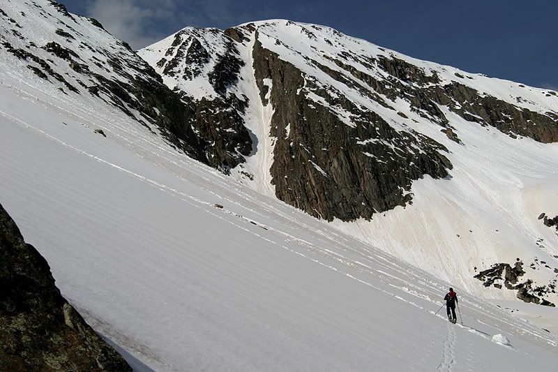
Overnight temperatures of the snowpack have left a little to be desired. Local NWS point forecast suggested 29 degrees and clear skies at 12,200' SW of Minturn for Saturday night. Whether or not that would be adequate for a good freeze was iffy. It sounded good enough to at least have a look though. I emailed IridePow and we discussed this, and eventually decided to meet up at the park and ride at 4:00am. The drive to the TH took roughly 2.5 hours, and was manageable in IridePow's Audi wagon.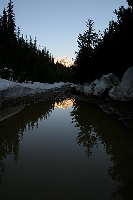
After debating on our starting point, we decided on a small field a little ways before the end of the road. We figured the ascent would be easiest if we contoured north and met up with the Missouri Creek trail. At 7:00am we left the road and began the climb, both of us on our splitboards.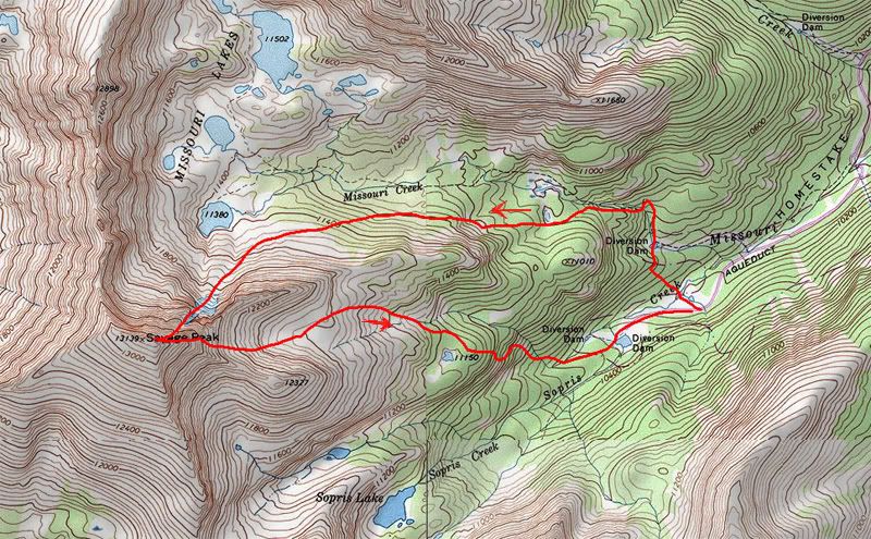
At roughly 10,200' the snow was nice and firm, and the vehicle's thermometer read 30 degrees. We headed up and to the north en route to the trail, crossing Sopris Creek on a fallen tree. Shortly after, we were greeted by a tricky crossing of Missouri Creek. I found a thin enough section for a pole planted jump, and Iride crossed on an icy log. We followed the creek on its north side, and shortly came to a bridge. :roll: The trail crossed back onto the south side, and we followed it with help from some tree blazes. Snow in the trees started to soften a little bit, but remained firm enough to support our weight up to treeline.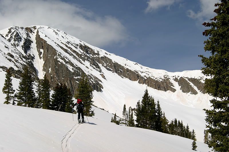
After about 1.5 hours, we exited the trees and got our first view of the Savage.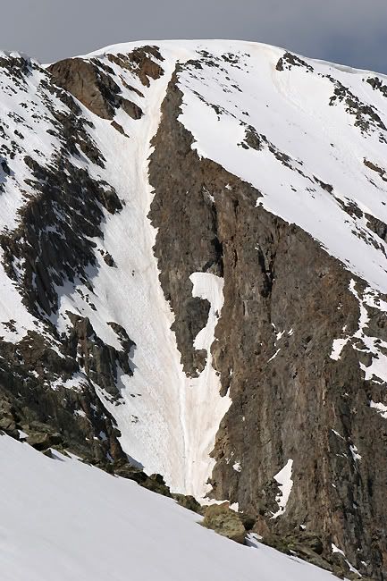
We also had decent views of the surrounding peaks,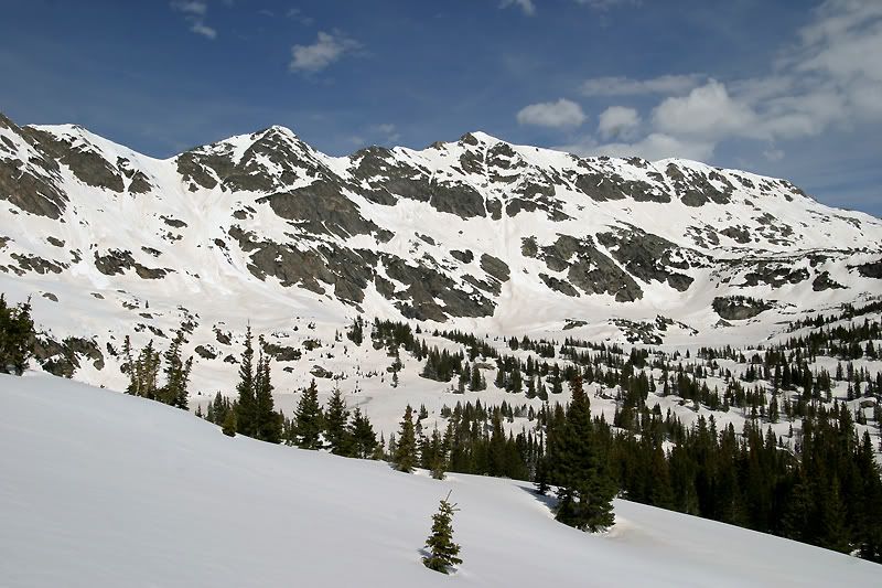
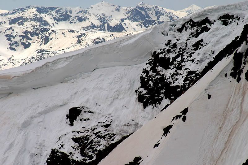
and some recent wet slide activity.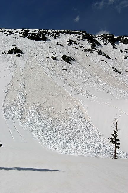
It appeared that this activity was happening on the dirty layer, not far below the top of the snowpack. The couloir itself looked pretty dirty as well, with about a 2 foot wide runnel going down the right hand side. It wasnt smooth corn, but it looked manageable. Around 9:15am we reached the base of the climb.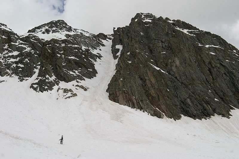
We stored the boards and put on crampons for the ascent. Snow was softening some, and each step went in about to the ankle.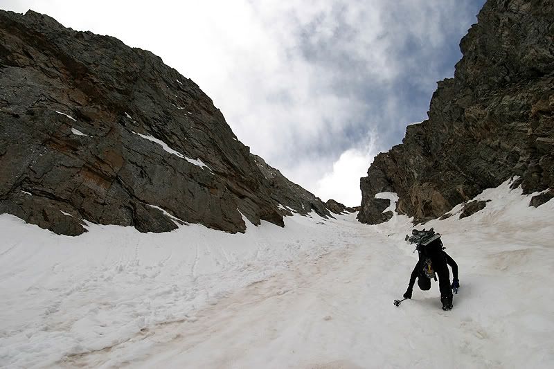
During the ascent you couldnt help but notice this beauty on gawkers right, looking NE from the Savage.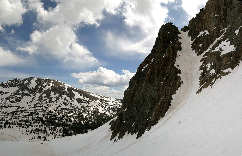
It was too steep for my tastes though. Clouds had begun to build as we made our way up the couloir.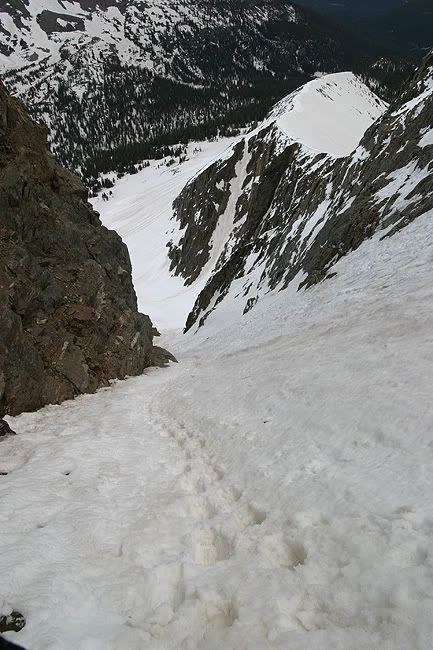
This helped to keep the snow a little cooler, and it remained good to climb almost to the top. Unfortunately, these clouds started to drop hints that the weather was changing. First some really light snow off and on, followed by the soft rumbling of distant thunder. I guess its that time of year again. We'd stop to listen every once and a while, but it never sounded too close. The forecast had called for possible T storms, but the percentge was around 20-30%. Towards the top of the couloir we decided to keep going and things started to go downhill.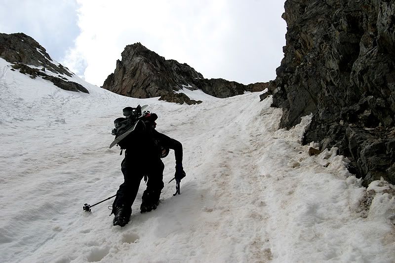
The couloir had a small y in it, we took the slightly steeper right branch as the aspect of the slope turned to more east facing. With this new aspect and the lack of protection from the couloir walls, the snow started to get ugly. The last 15 feet we were sinking in a bit more. At this point the thought of bailing entered my mind (it tried to get a word in during the sounds of thunder). Eager to get off the loose snow we stayed on the extreme right of the couloir and climbed a few rocks before topping out. In hindsight I wouldnt have attempted this again, if the snow had failed the results wouldnt have been pretty. Its amazing how fast conditions can change within a matter of feet. Then as if that moment wasn't enough excitement for the day, I started to hear a strange squeaking sound, like the air slowly escaping from a water bottle. I started to check over IridePow's backpack and couldnt locate the source. Then I grabbed the top of his snowboard and the sound stopped. Probably less then 100 feet from the top, and its time to get down now. We took a low stance and made our way down along the ridge. Should we have ditched our packs with equipped lightning rods and waited it out? I dont know, my thoughts were only of getting lower asap. After we dropped down a good ways, we felt a little more comfortable and briefly considered entering the couloir from the other branch, which was more north facing and not as steep. However the top 30 feet still appeared to be pretty loose, and entering the couloir by riding a sluff was not something I wanted to try. Add this to the fact that we just witnessed a cornice collapse on Savage's south ridge. We strapped in and made our way down the east ridge.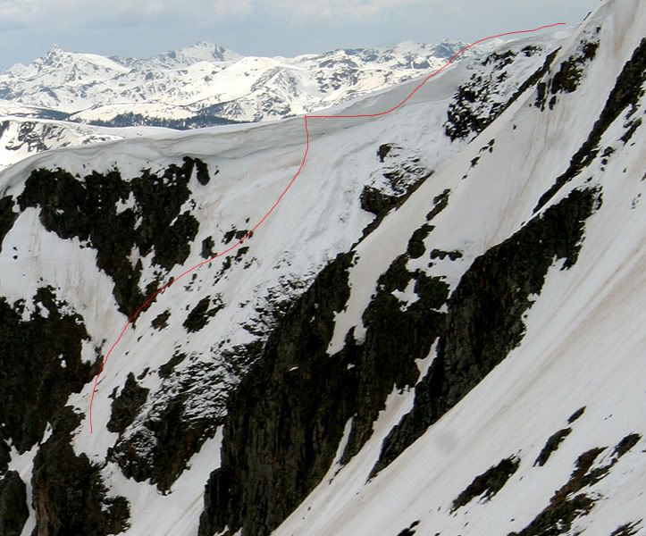
To the left of the ridge crest was a severe drop off, and to the right was a SE facing slope of unsupportable rot. Fortunately the ridge was of a low enough angle to grant access to the lower east bowl. We made quick work of this and rode down on the firm dust layer to treeline.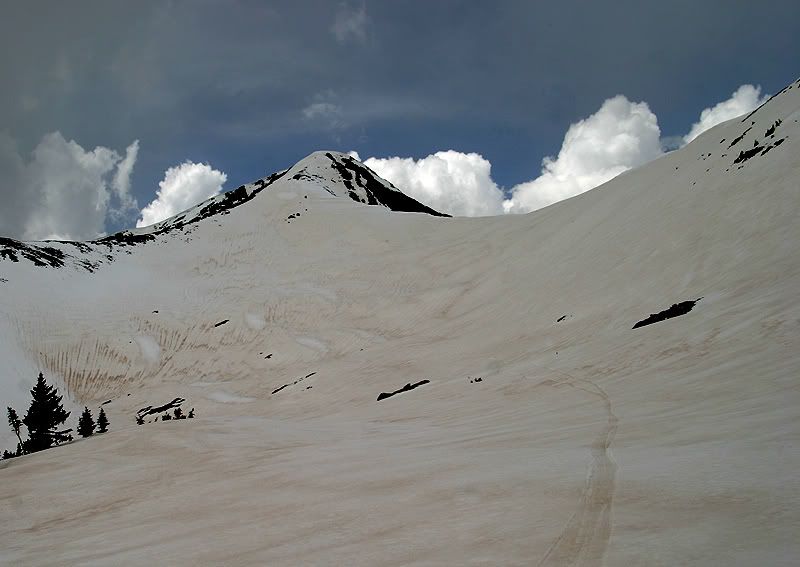
We made our way E SE towards Sopris Creek, contouring around some cliff bands, then posholing some steep trees until we reached the valley. We skinned up again and skied along the creek and back to the road. After a quick stroll on the road we reached the car at around 2:30p.
Yesterday a couple of lessons were learned. The tops of couloirs are not a place you want to discover rotten snow, and "distant" thunder should always be respected, even on partly cloudy days. That and its definitely not corn season yet. I think next weekend I'll go fishing.
***************************************************
Some of my personal comments (Oliver):
Great line, but it just was not meant to be.
That moment with the buzzing was the scariest moment I have had so far in my life!!!
I am just happy everything turned out alright.
I definitely learned some lessons that day.

No comments:
Post a Comment